Expert As-Built Survey Services for AEC
Precision in Building Survey and Laser Scanning for AEC Projects
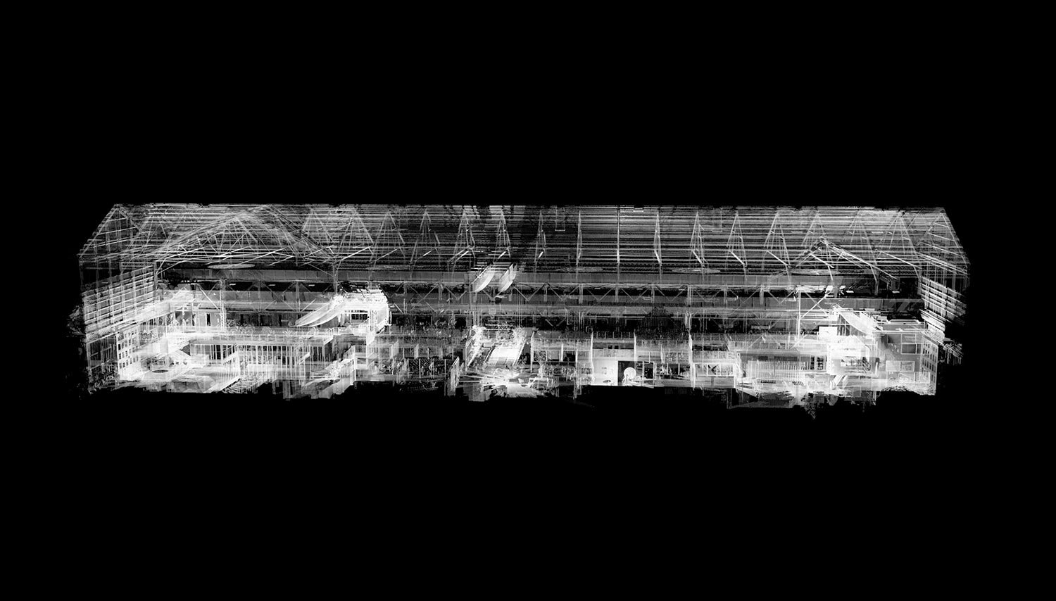
At MYND Workshop, our As Built Survey services are tailored to meet the comprehensive needs of the AEC industry. Using the latest in 3D laser scanning technology, including terrestrial laser scanning, we deliver accurate building surveys and laser scanning surveys. Our expertise extends to onsite surveying and control point surveying, ensuring each project, whether involving historical buildings or modern structures, receives the highest level of precision.

Our team specializes in creating detailed as-built surveys and point cloud scans, leveraging 3D laser scanning equipment to capture every nuance of the structure. From architectural surveys to warehouse scans, we provide a thorough analysis of existing conditions, utilizing our deep understanding of as-built documentation and building scanning to bring clarity and accuracy to every project.

Frequently Asked Questions
-
An As Built Survey is a comprehensive process of documenting the exact specifications, dimensions, and location of a building or structure as it has been constructed. It differs from original design plans, capturing any alterations made during the construction process. This survey is crucial in the AEC industry for ensuring that the final construction reflects accurate, real-world data, which is essential for future renovations, maintenance, and reference.
-
Terrestrial laser scanning in as-built surveys involves using ground-based laser technology to create detailed 3D representations of structures, essential for accurate documentation in AEC.
-
At MYND Workshop, we provide a variety of file formats to view point cloud and as-built survey data, catering to the diverse needs of AEC professionals. A particularly useful format we offer is the Autodesk Recap project file. These files allow professionals to interactively navigate the 3D point cloud, enabling them to take precise measurements, examine details, and fully explore the surveyed area in a virtual environment. This approach ensures you have comprehensive access and control over the survey data, facilitating informed decision-making and detailed project planning.
-
The cost of a Point Cloud Survey varies based on several factors, such as the scope and complexity of the project, the size of the area being scanned, and specific client requirements. Typically, the pricing structure includes a base daily rate for the scanning process, followed by additional costs for processing the data into usable formats like 3D models or 2D drawings.
-
Survey control points are crucial in as-built surveys for establishing accurate reference points, ensuring the precision and reliability of the data collected from laser scanning surveys. Control points are more often required on very large and complex projects which span a large horizontal or vertical distance.